iOS App · SwiftUI · Canada

Amateur
Radio
Canada

The essential companion for licensed Canadian amateur radio operators — band plans, repeaters, bearing tools, live propagation data, and quick reference, all in one.

📡 Band Plans 🗺 Repeater Map ☀️ Live Conditions ☁️ iCloud Sync
Band Plans detail view
Band Plans list

Five tabs. Everything on the air.

Built for the Canadian amateur radio community — from LF to 24 GHz, offline-capable, no ads, no account required.

📶
Band Plans
Complete Canadian allocations per RAC / ISED RBR-4, from 2200m to 24 GHz.
📡
Repeaters
Find, filter, and manage Canadian repeaters with map and bearing lines.
🧭
Bearing
Geodesic bearing and distance from your location to any point on the map.
☀️
Conditions
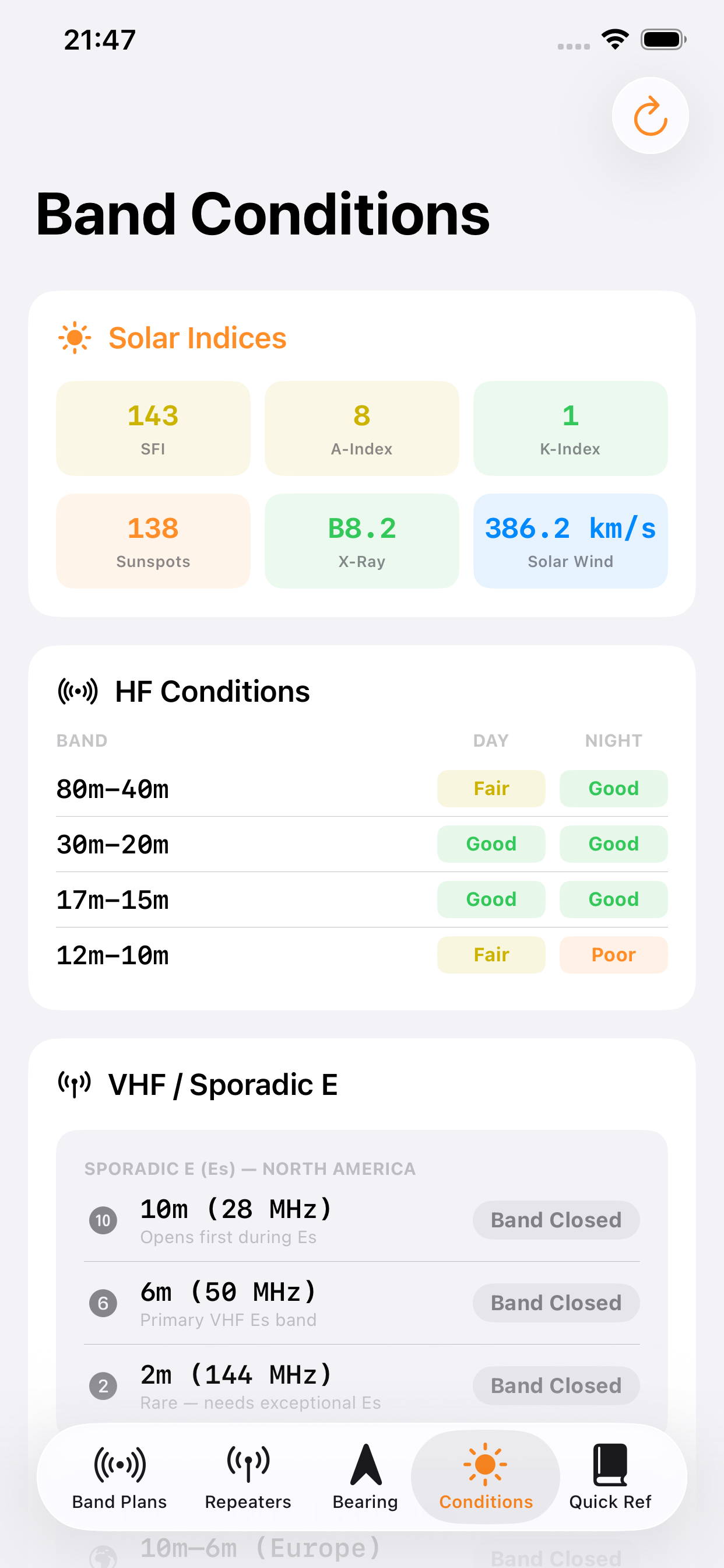
Live solar indices, HF band conditions, and VHF sporadic-E from HamQSL.
📖
Quick Ref
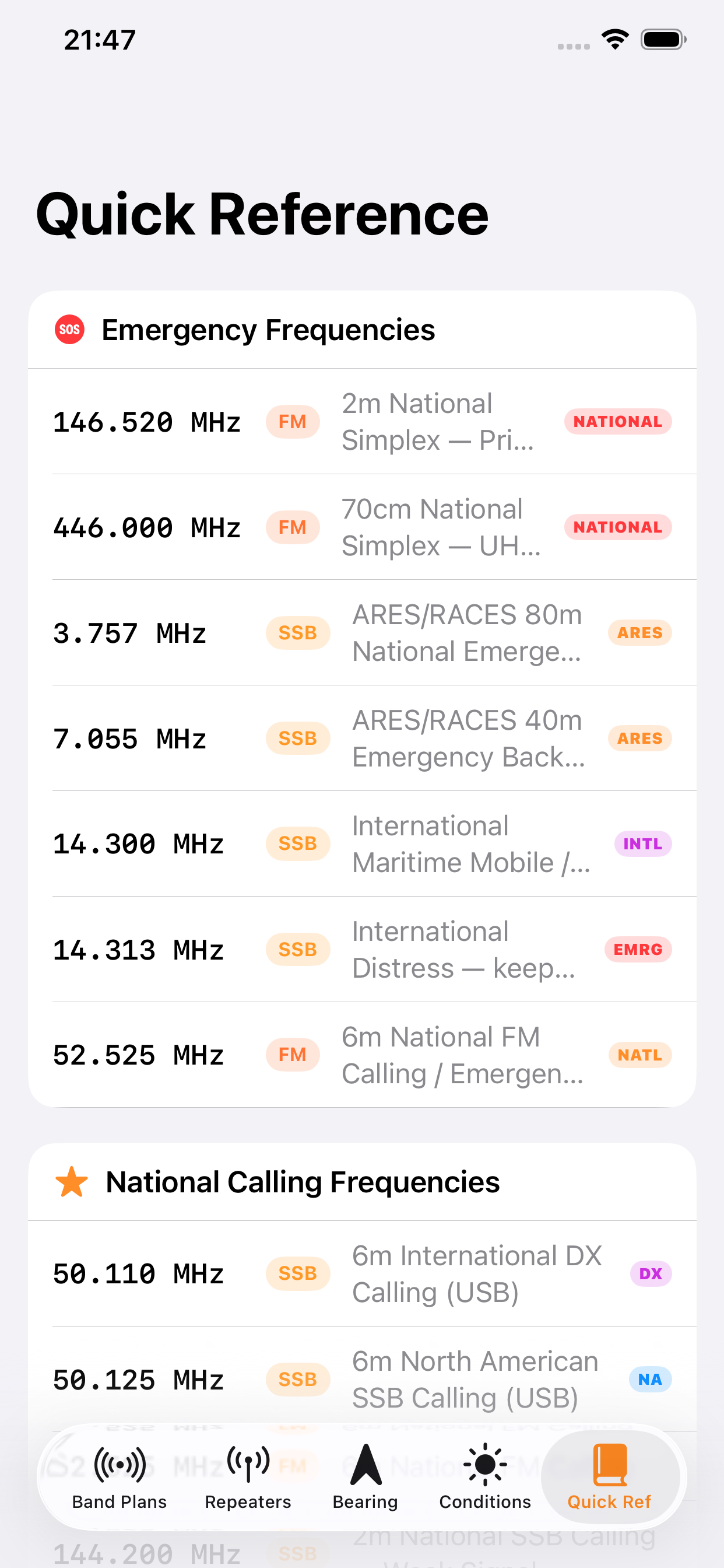
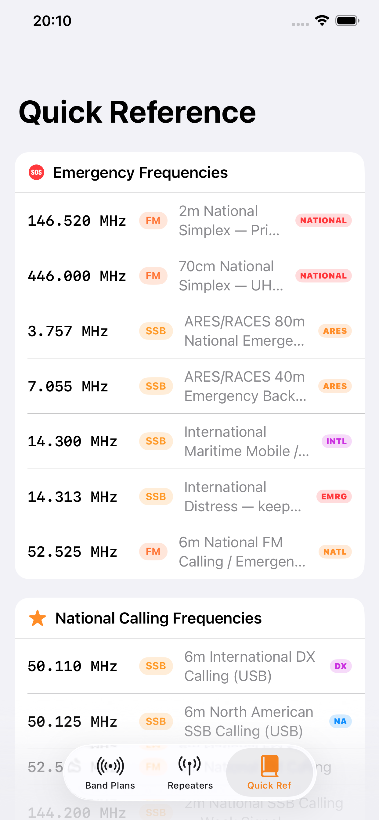
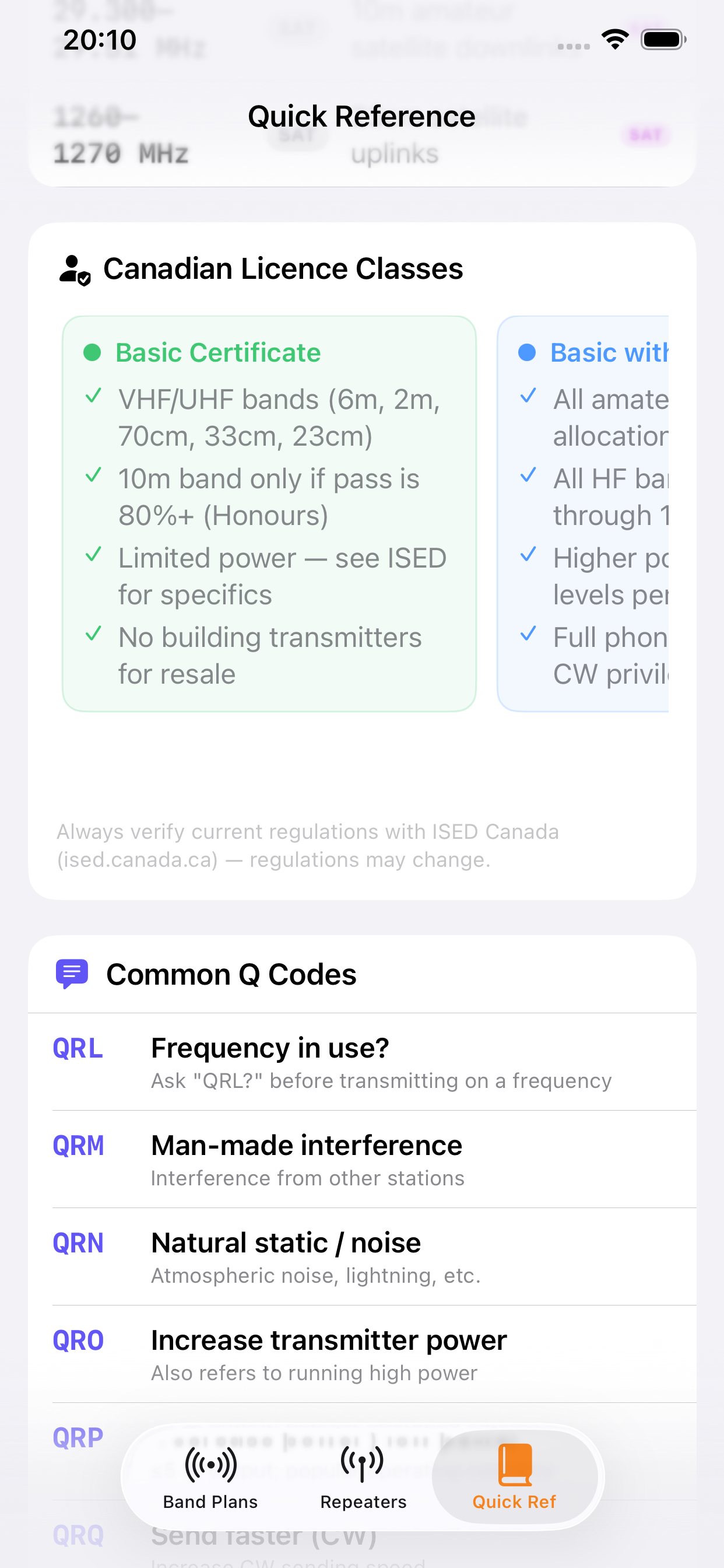
Emergency freqs, digital modes, satellite, Q codes, and licence classes.
Tab 1 · Band Plans

Every Canadian band,
precisely mapped.

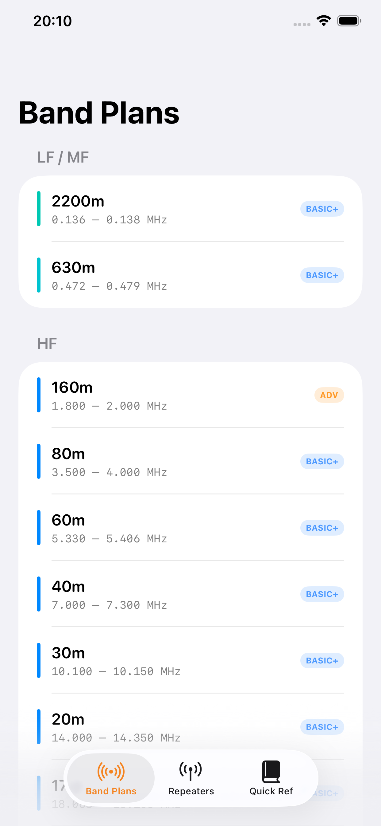
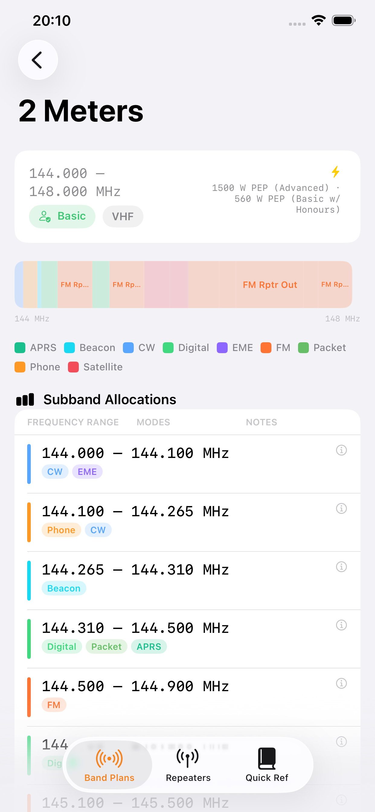
Full Canadian frequency allocations per RAC / ISED RBR-4 Schedule I, Issue 3 — from 2200 metres to 24 GHz. Colour-coded subbands, mode legends, key calling frequencies, and licence class requirements at a glance.

  • LF, MF, HF, VHF, UHF, and Microwave bands in one sidebar
  • Proportional subband frequency bars — tap to explore
  • Calling and emergency frequencies with NATIONAL badges
  • Licence class per band: BASIC, BASIC+, or ADVANCED
  • Max power limits and mode restrictions clearly shown
Band Plans list
2m band detail
Tab 2 · Repeaters

Canadian repeaters,
everywhere you go.

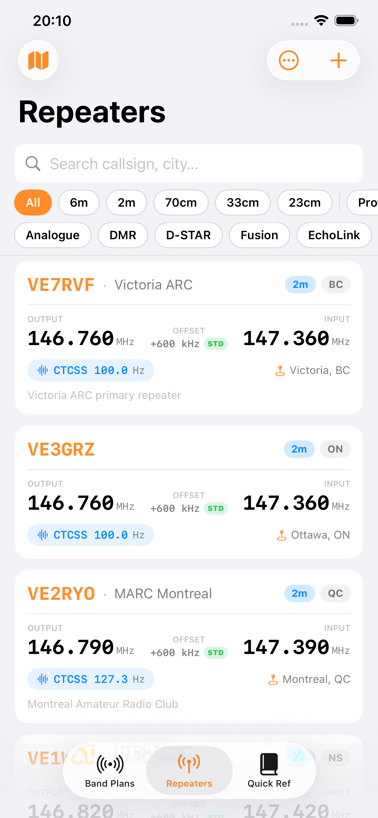
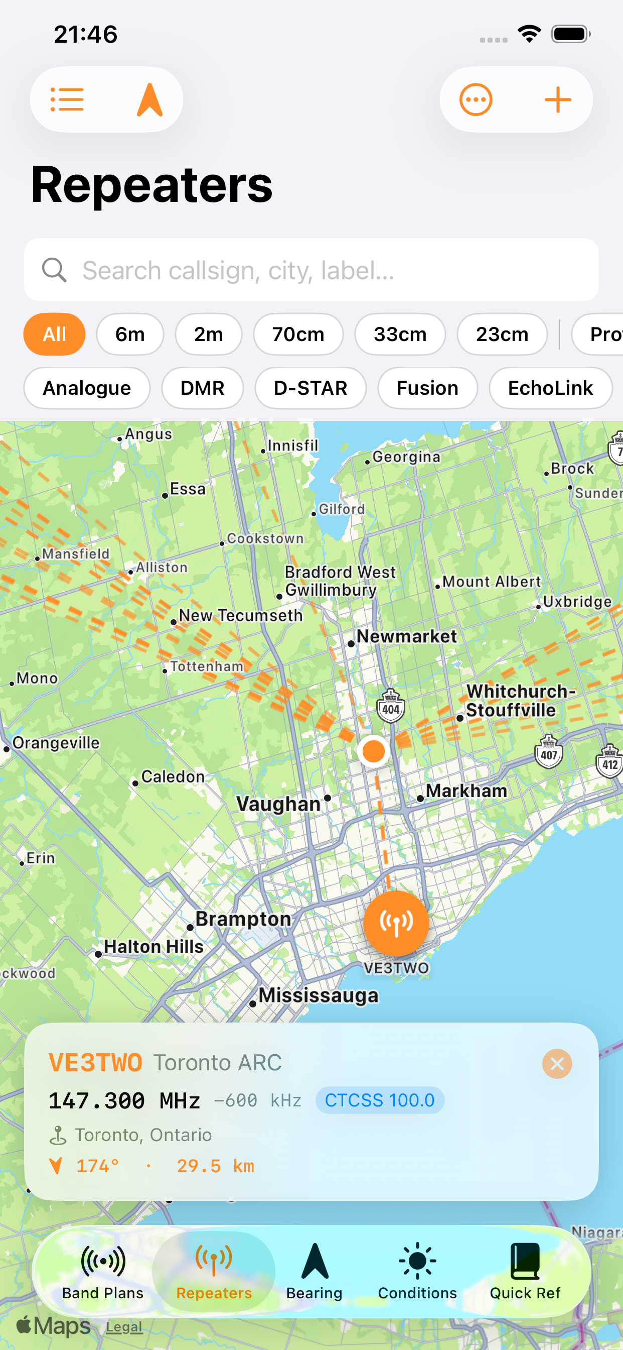
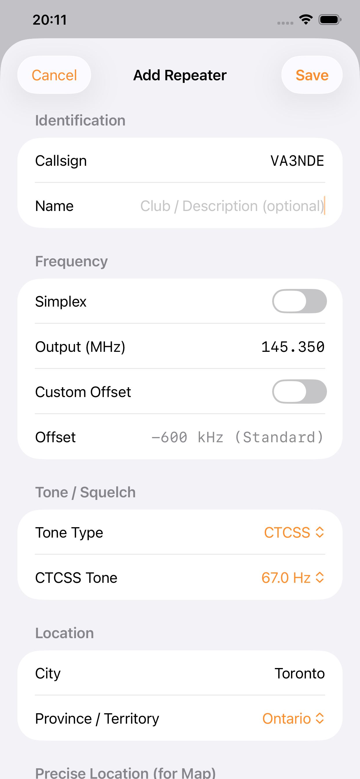
A comprehensive repeater database with powerful filtering — by band, province, and technology. Flip to map view to see great-circle dashed bearing lines from your location to every repeater across Canada.

  • Filter by band, province, and technology (DMR, D-STAR, Fusion…)
  • Map view with orange dashed great-circle bearing lines
  • Add your own repeaters and personal key frequencies
  • CTCSS (38 tones) and DCS (101 codes) support, auto offset detection
  • iCloud KV sync keeps your data across all devices
Repeaters list
Repeater map callout
Tab 3 · Bearing

Know your heading
before you key up.

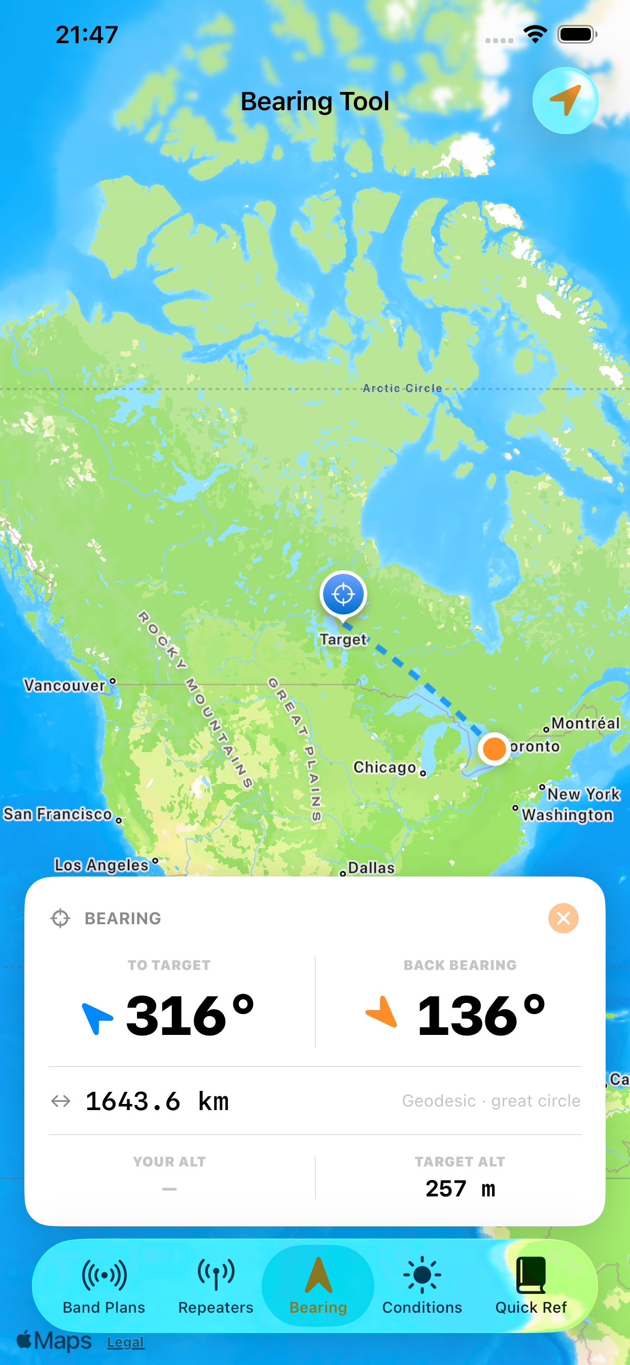
Tap anywhere on a realistic elevation-style map to instantly calculate geodesic bearing and great-circle distance from your GPS location. Back bearing, elevation angle, and target altitude are all in one compact card.

  • Forward and back bearing — reciprocal ±180° shown together
  • Geodesic great-circle distance in kilometres
  • Elevation angle using GPS altitude + open-meteo.com target elevation
  • Curved 25-point arc rendered on Mercator map — no MapKit geodesic API
  • Tap-to-place custom target marker with blue visual indicator
Bearing tool
Tabs 4 & 5 · Conditions & Quick Ref

Live conditions and
instant reference.

Real-time solar flux, A-index, K-index, and HF band conditions from HamQSL — colour-coded for quick reading. Plus an offline quick reference covering emergencies, digital modes, satellite freqs, Q codes, and Canadian licence classes.

  • Solar indices: SFI, A-index, K-index, sunspots, X-ray, solar wind
  • HF and VHF sporadic-E conditions, day and night split
  • Emergency frequencies always offline — no network needed
  • 20 Q codes with plain-English meanings and usage notes
  • Licence class privileges: Basic, Honours, and Advanced
Band Conditions
Quick Reference

Optimised for the big screen.

The adaptive SwiftUI layout uses NavigationSplitView to give iPad users a full sidebar and detail pane simultaneously — every repeater, every band, side by side.

NavigationSplitView Full-width Repeater Cards Landscape Map View
Amateur Radio Canada on iPad

Built the right way.

Pure SwiftUI
No UIKit, no third-party dependencies. Every view is native SwiftUI using @StateObject, @EnvironmentObject, and a custom FlowLayout for wrapping mode chips.
☁️
iCloud Sync
Repeaters and key frequencies sync across devices via NSUbiquitousKeyValueStore, with UserDefaults as a fast local fallback and automatic reload on external change.
📐
Great-Circle Math
Forward azimuth, reciprocal bearing, geodesic distance, and 25-point arc interpolation — all implemented in pure Swift. No MapKit geodesic API required; curves render correctly on Mercator projections.